
- Shelter
- NW, N, NE
- Seabed
- sand
- Anchoring
- Allowed
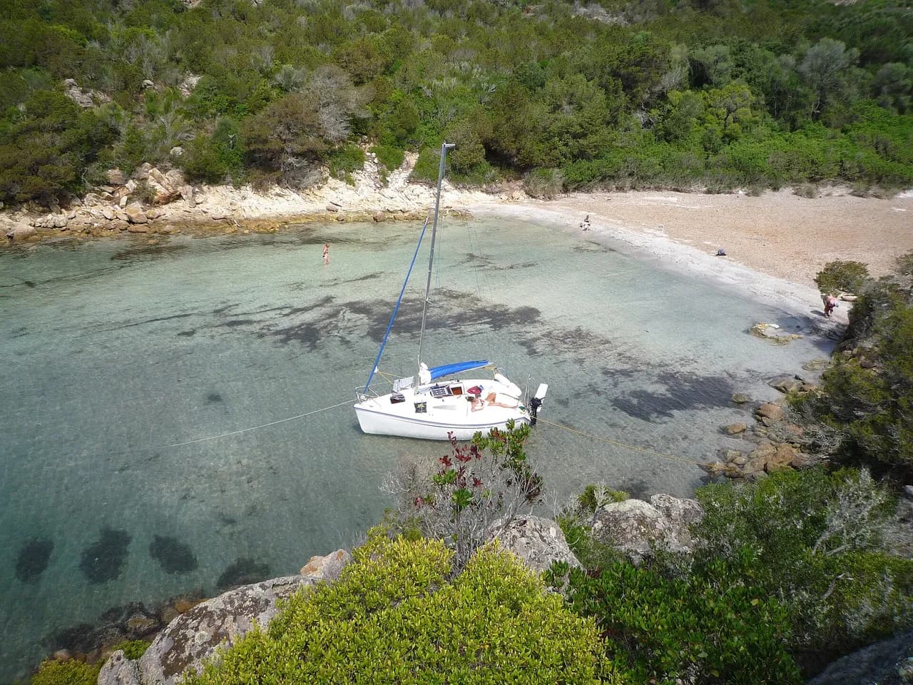
Small cove on the Riviera coast between Èze and Cap-d'Ail, sand bottom, sheltered from N and NE winds.
- Beach
Guide
Approach and anchoring
Approach from the south in clear water. Anchor on sand in 5 to 10 metres, though the bottom carries patches of posidonia that can spoil the holding. The cove rolls even in calm weather and is exposed to winds with a southerly component and to the wash of passing traffic. It fills with boats in season. Port de Silva Maris lies 1.4 NM to the west and Cap-d'Ail 1.5 NM to the east if shelter is needed.
Ashore
A small pebble beach lies at the head of the cove, backed by high cliffs, and is used by naturists.
Key facts
- Type
- Anchorage
- Coordinates
- 43.72186, 7.38265 (43°43.31'N 7°22.96'E)
- Country
- France
- Shelter
- Sheltered from north-west, north, north-east winds
- Seabed
- sand
- Anchoring
- Allowed
- Services
- Beach
- Boaters' rating
- 4.3/5
- Last updated
- October 15, 2026
Getting there
Crique di Cape Estel lies at 43°43.31'N 7°22.96'E, that is 43.72186, 7.38265 in decimal degrees.
Boaters' reviews
No reviews yet. Be the first to share your experience of Crique di Cape Estel.
Write a reviewFrequently asked questions
Which winds is Crique di Cape Estel sheltered from?
Crique di Cape Estel is sheltered from north-west, north, north-east winds.
Can you anchor at Crique di Cape Estel?
Yes, anchoring is allowed at Crique di Cape Estel.
How do boaters rate Crique di Cape Estel?
Crique di Cape Estel is rated 4.3/5 by boaters on BoatMap.



Explore the region
- France
- Provence and Côte d'Azur
- Riviera · Alpes-Maritimes
- Camargue and Gulf of Fos
- Marseille and the Calanques
- Var
Nearby cities
L'app de navigation bateau, gratuite
Cartes marines officielles, météo marine, GPS et 50 000+ ports et mouillages avec avis. Tout en une seule app, prête à embarquer.



