The free boat navigation app
Official nautical charts, marine weather, GPS and 50,000+ marinas and anchorages with reviews. All in one app, ready to sail.
Download for free


Boaters love BoatMap
Excellent! Everything I've been looking for, way better than Navionics, the charts are top notch.
Mat J.
Finally a navigation app that's done right. Absolutely nothing missing. Being able to follow your friends' trips at sea is brilliant too. 100% recommend ⛵️
Zel5678
I'm on the Explorer plan, the charts are gorgeous, better than Navionics. The anchorage scores factor in the weather, really useful to plan a trip.
VicViiic
I highly recommend this app! It has all the info you'll need to navigate like a real captain.
LizzzLizzz
As someone passionate about fishing and spearfishing, I found BoatMap really handy, well designed and especially simple to use. I highly recommend it.
BainBain000
I highly recommend this app: reliable, easy to use and accurate. Perfect for sailors, seasoned or beginners ⛵️
Clémence D.
One app, all your navigation tools.
Official nautical charts, marine weather, 50,000+ marinas and anchorages with reviews, route planning. All in your pocket, ready to go.


50,000+ marinas and anchorages, reviews and photos
- Real-time shelter score based on weather
- Recent photos and reviews
- Holding, seabed type, local restrictions
- Water, fuel, WiFi, showers, harbor office
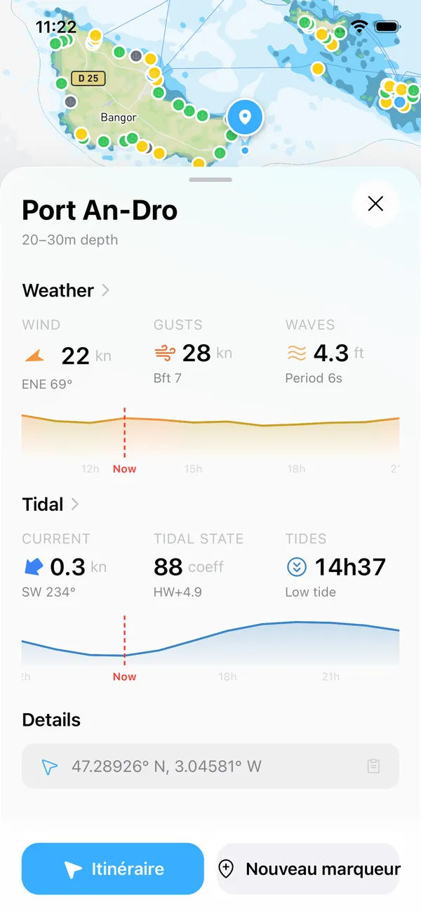


Marine weather at a glance
- Real-time wind with direction and gusts
- Wave height and swell
- Tides and currents for your area
- 16-day forecast
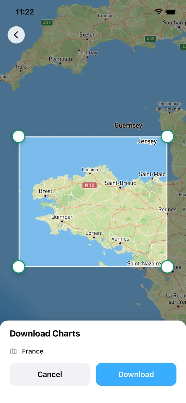
Official nautical charts, accessible offline
- 40+ maritime symbols (buoys, beacons, landmarks, soundings)
- Depth contours and bathymetric data
- Anchorage zones, channels and hazards
- Available offline
Everything you need, nothing you don't
Offline charts
Download your zones before you leave. Charts stay available with no signal.
Background GPS tracking
Your track records even with the screen off. No need to keep the app open.
Battery-friendly
Adaptive GPS that sips power. Enough battery for the whole trip.
Live marine weather
Wind, waves, tides. No surprises once you're out at sea.
Route planning
Plan your route at the dock and spot hazards before leaving.
Private and secure data
No reselling of GPS tracks. Encrypted, hosted in Europe.
Download and navigate safely

Monthly or yearly, your call.
Start free. Upgrade to Explorer when you want, cancel when you want.
Get started for free

On the water in 30 seconds
Download
Install BoatMap free from the App Store or Google Play.
Explore
Discover marinas, anchorages, and points of interest around you.
Navigate
Start your trip, record your track, and enjoy the ride.


Your next trip starts here.
Join 10,000+ boaters navigating with BoatMap.
